
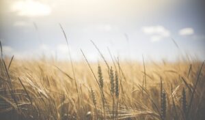
Land-use changes are a root cause for many sustainability challenges, such as food security, climate change and biodiversity loss. A profound understanding of land-use changes is therefore essential to foster a better understanding of the human interactions with the environment. Obtaining a deeper knowledge of the dynamics of land-use change and its underlying factors, together with an assessment of the effectiveness of different land management practices at various scales in providing sustainable solutions, represent important milestones for tackling climate change and biodiversity challenges. Focusing on Europe, Europe-LAND will provide a better understanding of these multiple interactions, synergies and trade-offs amongst the factors that influence land-use.
Our project vision is to facilitate targeted interventions for land-use in Europe by broadening our understanding of what drives and motivates land-use decisions, in order to gain a national, regional and pan-European vision that supports policy objectives such as climate change mitigation and adaptation as well as biodiversity conservation.
Europe-LAND is funded by the Program Európskej únie Horizon Europe.
In Europe-LAND, we are pursuing a set of national-level analyses (e.g. harmonization of fragmented data) and land-use surveys, implemented by eight local case studies as demonstrators, as well as comprehensive capacity-building to identify, develop, test and implement integrated tools to improve the understanding of the drivers behind land-use decisions as well as stakeholders’ awareness and engagement regarding climate change and biodiversity challenges in Europe.
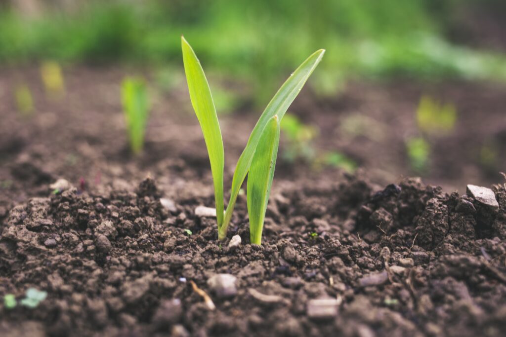
Europe-LAND measures how actors at various organizational levels use land and what drives their behavior. This behavior will be further explored by analyzing the decision-making behind the behavior, the factors influencing the decision-making, and the role of climate change and biodiversity challenges when deciding how to make use of land. We will map future expected land-use patterns, also comparing past and current situations as well as future trends. Adding an additional qualitative dimension through an empirical analysis of the Europe-LAND case studies, we will construct and test a conceptual telecoupling framework to analyze land-use strategies. Finally, a dedicated toolbox will enable project stakeholders such as policymakers, authorities, regulatory agencies, farm federations and agricultural organizations, spatial planning engineers, NGOs and further to identify in both spatial and temporal terms, how planned actions may affect current and future land use in a given region.
Syntéza, propagácia a rozširovanie výsledkov projektu sa zabezpečí prostredníctvom pevného súboru informácií, komunikácie a rozširovania, ako aj budovania kapacít na preklenutie medzery medzi teóriou a praktickými inováciami. Europe-LAND bude motivovať zainteresované strany, aby sa aktívne zapájali do aktivít projektu zameraných na budovanie kapacít s cieľom získať nové poznatky, zvýšiť povedomie o výzvach súvisiacich so zmenou klímy a biodiverzitou a dozvedieť sa o inovatívnych prístupoch k udržateľnejšiemu využívaniu pôdy a hospodáreniu s pôdou v celej Európe.
Ako prierezový prvok bolo vybraných osem prípadových štúdií z rôznych častí Európy, ktoré zahŕňajú biosférické rezervácie a platformy LTSER. Zatiaľ čo biosférické rezervácie pripomínajú miesta na testovanie interdisciplinárnych prístupov k pochopeniu a riadeniu zmien a interakcií sociálno-ekologických systémov, dlhodobý výskum ekosystémov je ďalšou dôležitou súčasťou celosvetového úsilia o lepšie pochopenie ekosystémov. Prípadové štúdie projektu Europe-LAND, ktoré primerane pokrývajú rôzne európske regióny, slúžia na ilustráciu širokej škály kontextov a premenných využívania krajiny, z ktorých možno vyvodiť cenné ponaučenia pre udržateľné využívanie krajiny. Kliknutím na nižšie uvedené záložky sa dozviete viac o každom regióne prípadovej štúdie.
LTSER Región Eisenwurzen, Rakúsko (AUT)
The Eisenwurzen study region, spanning 5,904 km2, exhibits diverse landscapes, ranging from lowlands in the north to alpine mountains in the center (up to 2,445 m a.s.l.). With a continental climate, temperatures vary from -1.1°C to 9.6 °C, and annual precipitation ranges from 730 mm to 2,202 mm. Land use is varied, featuring intensive crop production in the north and significant forest and grasslands in hilly and mountainous areas.
Comprising 91 municipalities and 311,243 inhabitants, the region has concentrated settlement areas in the north and south, with socio-economic centers around Steyr and Wieselburg. Notable for its tourism centered on nature experiences, the region hosts two national parks (Kalkalpen and Gesäuse) and the nature and geopark Steirische Eisenwurzen. Historically rooted in iron mining, the region's tourism emphasizes the 'Eisenstrasse' (iron road) and mountain hut traditions, recognized as UNESCO cultural heritage since 2018. Challenges include emigration from mountainous areas, abandonment of remote agricultural lands, and a shift towards organic production. Climate change impacts the region, extending the growing season while posing challenges through increasing extreme events affecting agriculture.
Krkonoše Mts. National Park, Czechia (CZE)
The Krkonoše Mountains, straddling the Czech-Polish border, are an isolated mountain island in the middle of the lowlands and hills of central Europe. The laws and processes of nature in combinations with centuries-long economic exploitation of the landscape by man, have created an exceptionally varied mosaic of environments - Krkonoše forests (dominant ecosystem, especially spruce stands), meadows and wetlands on the foothills and slopes of the mountains, wildflower alpine meadows, alpine grasslands and the unique ecosystem of relict arctic-alpine tundra on the highest ridges. To preserve the great natural value, The Krkonoše National Park was declared in 1963. The mission of the Krkonoše National Park is, in addition to fulfilling the long-term protection goals, also the use of this territory for nature-friendly tourist acitivites, in ways that do not conflict with the long-term protection of the national park.
The nature and landscape of the Krkonoše Mountains have been marked by centuries of human presence. Once a hub for mountain farming, the decline of pastoralism in the mid-19th century led to the conversion of mountain huts into holiday cottages. Above 1000 m, isolated mountain huts and lodges are present, while residential buildings cluster in mountain resorts and scatter on slopes. Today, the Krkonoše Mountains are a popular area for summer and winter tourism. Its location, easy accessibility and good tourist infrastructure make it one of the five most visited national parks in the world. Despite the status of a national park, it is necessary to take care of the area. The management and intensity of care vary in different parts of the Krkonoše Mountains taking into account the designated protection zones.
Okres Saaremaa, Estónsko (EST)
Saaremaa County, one of Estonia's 15 counties, spans 293,832 ha, including Saaremaa (2,673 km²) and smaller islands like Muhu, Ruhnu, Abruka, and Vilsandi. In 2022, it housed 31,292 people, 2.4% of Estonia's population. The West Estonian islands are low-lying plains with limestone as the base rock, featuring specific habitats like alvars and wooded meadows. Traditional management practices declined, leading to habitat overgrowth, now under restoration efforts. The region boasts protected areas and high nature value, with the highest percentage of ecological farming in Estonia. Consideration for a UNESCO biosphere reserve is underway.
Vzhľadom na svoju jedinečnú prírodu kladie región dôraz na udržateľné hospodárske činnosti, najmä ekologické poľnohospodárstvo a cestovný ruch, aby sa zachovali prírodné hodnoty a podporili miestne príjmy.
Schorfheide-Chorin Biosphere Reserve, Germany (GER)
The Schorfheide-Chorin Biosphere Reserve, one of Germany's largest protected areas with 1,291 km², was designated an UNESCO Biosphere Reserve in 1990. The northern part in the Uckermark is predominantly arable land with many lakes while the south-western part is characterized by sandy soils and forested landscapes. One third of the forest areas of the biosphere reserve is covered with near-natural mixed beech forests, frequently intersected by swamps and open landscape elements.
The region experiences a transitional climate between temperate-oceanic and sub-continental, with average annual temperatures of 8-9°C and annual rainfall between 480 mm – 580 mm, making it one of the driest regions in Germany. Conservation efforts have prevented substantial vegetation changes and facilitated an increase in large mammals, particularly wolves. Wetlands and water bodies play a crucial role in maintaining ecological balance and serve as a habitat for diverse plant and animal species, as well as an important natural carbon sink. Renowned as a birdlife haven, the Reserve's forests, wetlands, and water bodies attract both local and migratory species, making it a vital stopover point for migrating birds.
Białowieża Forest, Poland (POL)
The Bialowieza Forest, straddling the Polish-Belarusian border, is a unique forest complex covering 1,250 km² (580 km² in Poland). It's the last of its kind in European lowlands, boasting extensive old-growth forests and diverse ecosystems. Designated a UNESCO World Heritage Site in 1979, it highlights the Central European mixed forests terrestrial ecoregion.
The forest supports complete food webs with large mammal and carnivore populations. Various factors, including protected areas, demographic challenges, economic development, protected area with strict rules, tourism development, and soil quality, influence future land use. Stakeholders, such as forest authorities national park authorities b, local society, local governments, inhabitants, NGOs, and tourists, have diverse interests. Past instruments at national and regional levels aimed to address social-environmental issues.
Biosférická rezervácia Castro Verde, Portugalsko (POR)
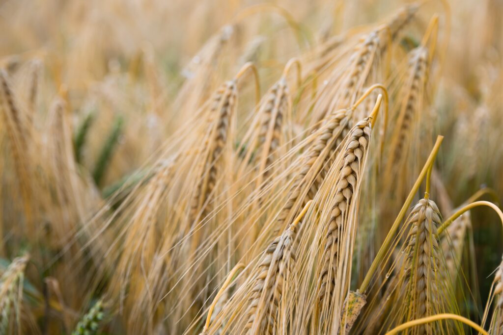
The Castro Verde Biosphere Reserve, spanning 567.2 km² in inland south Portugal, features a spatial-temporal landscape mosaic, perfectly adapted to the ecological composition of the territory and the human activities that take place there Agriculture and livestock are vital to the region's cultural and environmental characteristics, with vast cereal crops and grasslands known as cereal steppes. This agro-ecosystem, rooted in a millennial relationship between humans and nature, faces endangerment due to ecological issues and economic factors. This region also includes a mining industry, particularly the Neves-Corvo mine, providing employment and boosting the local economy.
Napriek zraniteľnosti obilné stepi podporujú bohatú biodiverzitu a hosťujú ohrozené stepné vtáky, ako je drop veľký, drop malý a poštolka malá. Prípadová štúdia sa zameriava na pochopenie vplyvu agroenvironmentálnych opatrení na poľnohospodársku produkciu a biodiverzitu v rezervácii. Analýza historických údajov vrátane 30 rokov prvého zonálneho plánu v Portugalsku zahŕňa vytvorenie geodatabázy zo snímok diaľkového prieskumu Zeme, máp pôdnej pokrývky a informácií o poľných parcelách. Cieľom štúdie je odhadnúť minulé, súčasné a budúce ekosystémové služby a biodiverzitu pri rôznych scenároch využívania pôdy, hospodárenia a zmeny klímy. Participatívnymi metodikami sa určia budúce očakávania, antropogénne hrozby a interakcie medzi človekom a divokou prírodou, čo prispeje k opatreniam na zvyšovanie povedomia.
Braila Islands, Romania (ROM)
Brăila Islands is located in south-eastern Romania, between the main branches of the Danube river. The study area covers about 97,000 hectares and includes two distinct areas: a predominantly agricultural area, the Big Brăila Island (over 71 000 hectares) and a wetland protected area, Balta Mică a Brăilei Natural Park (24 100 hectares).
Big Brăila Island experienced significant land use/cover changes over the communist period by converting wetlands into agricultural lands. Currently, arable lands represent over 72% of the total area, with the largest agricultural farm in Europe (over 56,000 ha) located here. Two communes share the area of the Island, with a population of around 3,500 inhabitants (2023). Agriculture is the main economic activity, with cereals being the dominated crops.
Balta Mică a Brăilei Natural Park is a wetland of international importance included on the RAMSAR list (since June 2001) and a Natura 2000 Site since 2008, with the landscape dominated by water (lakes, inland marches, water bodies) and forest ecosystems. The main activities are tourism, navigation, recreational/sports, fishing and pastoral activities. Over 90% of the total surface area of Balta Mică a Brăilei Natural Park is state property, the rest being private.
LTSER Trnava, Slovakia (SK)
LTSER Trnava is situated in south-western Slovakia, encompassing one city (Trnava) and 22 rural municipalities across a total area of 364 km². Trnava serves as the administrative center for the county and is a hub for population, trade, and industry. The LTSER itself characterizes an area marked by intensive industrial and agricultural activities, giving rise to specific environmental challenges such as a high degree of environmental contamination and degradation processes affecting agricultural land.
Jedným z významných environmentálnych problémov je využívanie najúrodnejšej pôdy na výstavbu priemyselných parkov, čo výrazne ohrozuje ekologickú stabilitu regiónu. Oblasť čelí nízkemu stupňu ekologickej stability, čo zdôrazňuje potrebu udržateľných postupov a environmentálneho riadenia.
Europe-LAND sa riadi metodologickým prístupom, ktorý umožňuje prepojiť analýzy na národnej úrovni s konkrétnymi miestnymi príkladmi. Pomocou participatívnych prístupov konzorcium vytvorí komplexný hodnotiaci rámec založený na ekologických, klimatických, sociálnych, ekonomických, technických a politických aspektoch, ktorého cieľom je umožniť vhodné plánovanie a stratégiu využívania pôdy vo vzťahu k zmene klímy a environmentálnej politike.
Našu prácu sme rozdelili do súboru pracovných balíkov, ako je znázornené nižšie:
- WP 1: Koordinácia, riadenie a správa projektu (vedúci: Univerzita aplikovaných vied v Hamburgu)
- WP 2: Odhaľovanie správania sa v oblasti využívania poľnohospodárskej pôdy a jeho hnacích síl v Európe (vedúci pracovník: Univerzita v Kodani)
- WP 3: Informovanosť o rozhodnutiach týkajúcich sa využívania pôdy v súvislosti so zmenou klímy a biodiverzitou (vedúci: Geografický ústav Rumunskej akadémie)
- WP 4: Mapovanie budúcich očakávaných modelov využívania pôdy a pôdnej pokrývky v súlade s dlhodobými cieľmi (vedúci: Lotyšská univerzita)
- WP 5: Podpora úsilia o zmiernenie zmeny klímy a adaptáciu na ňu a tvorba politík v oblasti biodiverzity (vedúci pracovník: Slovenská poľnohospodárska univerzita v Nitre)
- WP 6: Súbor nástrojov EUROPE-LAND: (Vedúci: Aristotelova univerzita v Solúne)
- Pracovný balík 7: Informácie, komunikácia, rozširovanie a budovanie kapacít (vedúci: Univerzita aplikovaných vied v Hamburgu)
Europe-LAND has identified groups of stakeholders crucial to ensure the proper implementation, dissemination and potential of project results into policy and practice, towards a more sustainable European land use. The project has identified five specific stakeholder groups most relevant to the envisioned activities.
Researchers and Academics
The engagement of experts from research and academia in various fields (sustainability, land-use, land
management, land cover change, modeling, telecoupling, mapping, social sciences, etc.) is crucial to
broadening the knowledge base on project-relevant fields both within the project consortium to fill
potential expertise gaps, as well as beyond the project by sharing project results.
Planners
Stakeholders from the industry are involved during the scope of the project in several ways. For one, they are direct subject of the research into land-use behaviour and drivers behind land-use decisions, and are involved in focus groups, interviews, surveys and events within the living lab framework. They are also a main target group for dissemination and capacity building. As such, they are a valuable stakeholder group as they both deliver valuable input to the project research and are also able to directly implement and test project outcomes and recommendations.
Policymakers
Stakeholders from policy and government are relevant to the project, as they are actively engaged with and design the legal frameworks in which land-use decisions are made on a local, regional, national and international level. Connecting with this group of stakeholders allows the project to identify existing policies and upcoming developments, as well as policy and decision-making knowledge needs and potential hurdles to transferring EU legislation onto smaller scales. Engaging local authorities, especially in the regions of the eight project case studies, is beneficial in terms of participatory co-creation of knowledge and may particularly help to facilitate knowledge sharing on new land use and land management knowledge as well as formulate recommendations addressing also local needs and constraints.
Land Users
Community-based and societal stakeholders may support the implementation of project outputs and policy into everyday practice and raise awareness on sustainability issues such as climate change and biodiversity loss in relation to land-use. Media coverage is an important part of project promotion as it increases the local, regional and national reach, potentially informing further stakeholders about the project, who in turn might reach out to engage with the project.
Other EU projects
Other EU projects on related land-use and land cover topics are important for the Europe-LAND project to engage with, as this offers opportunities for mutually beneficial collaboration on events, outreach actions and scientific exchange and collaborations.
Interested in staying in touch? Join our stakeholder pool!

Univerzita aplikovaných vied v Hamburgu
Located in Hamburg, Germany, HAW Hamburg serves as the Project Coordination team for Europe-LAND.
Aristotelova univerzita v Solúne
Thessaloniki, Greece
Estonian University of Life Sciences
Tartu, Estonia
Prague, Czech Republic

In addition to our 12 partner universities, two universities are involved in Europe-LAND as associated partners: Univerzita aplikovaných vied v Turku, Finland and Vilnius University, Lithuania.
MOSAIC is an EU funded project working to understand and influence how land across Europe is managed.
PLUS Change is funded by the Horizon Europe program and aims to develop strategies and decision-making processes for land use that effectively address challenges related to climate change, biodiversity, and human well-being.