
From 19–21 November 2025, the Europe-LAND consortium held our virtual Project Management Board (PMB) meeting. Over three days, partners reviewed progress across all work packages, aligned on strategic directions for 2026, and exchanged on upcoming milestones related to the Europe-LAND Virtual Toolbox.
On the final day, we opened the meeting to members of the IACS Data Community of Practice and were delighted to welcome Marijn van der Velde from the Joint Research Centre (JRC) as our invited guest speaker.
Guest Lecture: Statistical Disclosure Control in Geospatial Agricultural Data
Marijn delivered a compact but rich lecture titled “Statistical Disclosure Control in Geospatial Data – Insights from Ongoing JRC Research.” His presentation drew from joint work with colleagues including Jon Skoien, Nicolas Lampach, and Helena Ramos, and connected to several recent JRC–Eurostat outputs on agricultural census data.
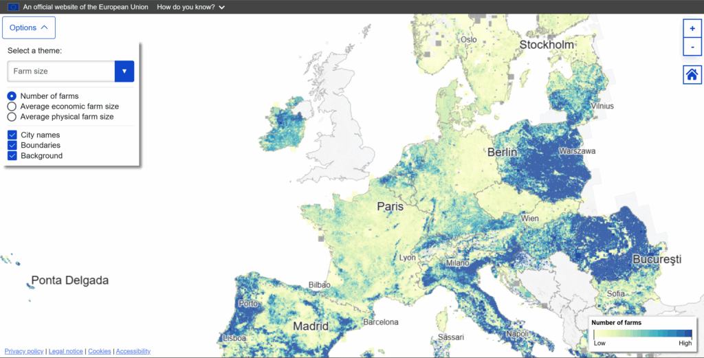
The talk focused on new experimental geospatial statistics derived from the 2020 EU Agricultural Census, covering more than 9 million farms across the EU. These datasets—now available via Eurostat—map key agricultural variables such as:
- Farm locations and main buildings
- Land use and crop area
- Livestock numbers and density
- Organic farming
- Farm typology, economic size, gender, and age distribution
One of the most innovative aspects is the multi-resolution statistical confidentiality method, which ensures privacy protection while enabling meaningful geospatial analysis. Instead of publishing fixed-scale grids, the JRC developed a hierarchical grid approach (1–5–10–20–40–80 km) that adapts to data density and applies contextual suppression to maintain anonymity. This method allows for more detailed, harmonized, EU-wide spatial datasets than previously possible.
Why This Matters for Europe-LAND
The work presented aligns closely with several Europe-LAND objectives:
- Improved understanding of farming systems: The new datasets reveal regional patterns in generational renewal, livestock density, crop diversity, and farm structures—crucial information for CAP monitoring and for regional analyses within the Europe-LAND use cases.
- Interoperability across data sources: Marijn highlighted linkages between census data, IACS (GSA) parcel data, Earth Observation inputs (e.g., Copernicus High-Resolution Layers), and farm accounting datasets. This approach reflects Europe-LAND’s ambition to bridge administrative, statistical, and EO systems.
- Practical relevance for the Europe-LAND Virtual Toolbox: These new experimental statistics can enrich Europe-LAND tools for benchmarking, visualization, and decision support. They also create opportunities for future exploitation and collaboration, for example through shared methodologies on data protection, harmonization, and grid-based analysis.
Access the Data & Learn More
The experimental geospatial datasets from the agricultural census can be downloaded directly from Eurostat: https://ec.europa.eu/eurostat/web/experimental-statistics/geospatial-data-agricultural-census
Learn more about the Europe-LAND Virtual Toolbox and how we are integrating such data innovations into user-centered tools: https://europe-land.eu/news/introducing-the-europe-land-toolbox-a-new-digital-platform-for-sustainable-land-use/
And explore the Comunità di pratica sui dati IACS, where ongoing knowledge exchange like this continues to drive our work: https://europe-land.eu/iacs-data-community-of-practice/
A warm thank you to Marijn van der Velde and colleagues for sharing their cutting-edge work and for the stimulating discussion with our consortium. Insights of this kind are directly feeding Europe-LAND’s mission to support data-driven, interoperable, and future-oriented agricultural policy implementation across Europe.